

Laois town's stud farm field one of seven sites rezoned for houses but flood zone refused

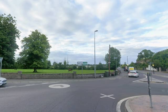

A stud farm’s field is one of seven in Mountmellick rezoned for housing developments, but a site in a flood zone was refused
Seven plots of land have been rezoned for new housing in Mountmellick town, but another in a flood risk zone was refused.
The rezonings were approved at the special meeting of Laois County Council on June 9, part of a county wide rezoning of over 28 acres to add some 8,000 homes in coming years in towns and villages across Laois.
In Mountmellick, a field belonging to Anngrove stud farm across from St Joseph’s Terrace has been rezoned from Strategic Reserve to Residential 2.
Unzoned land behind the newly built Grange Manor has been zoned Residential 2 also.
A field behind Esker Gate housing estate on the Portlaoise road has been changed from unzoned to Residential 2 and Open Space. It also borders the Derryguile road.
A field between the Bay Road Business Park and houses on Chapel Street has been changed from Strategic Reserve to Residential 2 and Open Space.
Another field at the back of a cul de sac of bungalows in Acragar has also been zoned to Residential 2.
Also in Acragar, a field next to the old Standex factory, once a quarry, has been zoned Residential 2.
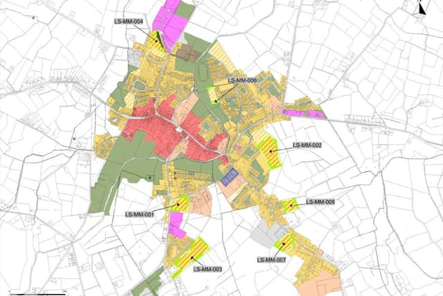
Part of the Smiths Field site has been rezoned from Open Space and Amenity to housing. That land, next to Kirwan Park, was bought in recent years by Laois County Council from Mountmellick parish to develop for housing.
They said when buying the site for €250,000 that it had potential for “26 housing units, two multi-use games pitches, car parking, playground and a walkway for residents in the general area”.
A 2.87 hectare field, owned by Ger Dunne was refused for rezoning.
The site borders the old graveyard on the Tullamore road, and New Road.
The council said zoning it would have been contrary to national policy. It said only 0.3 hectares was not in the flood risk zone.
“The Mountmellick Flood Relief Scheme indicates more extensive flood extents on the site than are submitted.
“There are more sequentially preferable sites that are proposed to be zoned within and immediately adjacent to the development boundary of Mountmellick that are not prone to flooding,” the Laois chief executive said when recommending no change to the zoning.
Several councillors argued for it to be included.
Cllr James Kelly from the Mountmellick Borris-in-Ossory Municipal District, asked if the Mountmellick flood defences will improve the site, or affect it more.
“We are working with guidelines that are 17 years old,” he said.
Cllr Aisling Moran said “a lot of flood zones haven’t flooded, why aren’t we looking at riparian buffers and river cleaning? We’re just looking at maps, seeing flood zones and moving on. Look at the Netherlands, it’s under water and they built so many houses,” she said.
The council’s Director for planning, Angela McEvoy said that “it’s national policy not to build houses on flood zones”.
“We are not prepared to bring this forward when so many other lands are available. It would be remiss of us”.
The council planners added that the land was not serviced, a “significant distance from the mains” and designated as rural.
Any future developments of the sites will have to successfully go through the planning process.