

New RSA website reveals Laois road collision blackspots with 23 serious injuries in recent years


New interactive site shows location of road injuries and deaths in every county in Ireland
A chilling new interactive website confirms the locations of 23 serious road injuries in Laois and one death, over recent years.
The Road Safety Authority (RSA) has launched a new interactive map identifying the location of road traffic injury collisions across Ireland, between the years 2016 and 2024.
Hovering over each location brings up the date, number and level of injury at the site, listing the injured people as drivers, passengers, cyclists, motorcyclists and an E scooter user.
The RSA say that the map will be an important tool for members of the public, researchers, local authorities and other stakeholders with an interest in road safety and collision data.
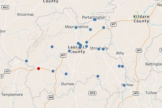
The data displayed on the map is based on injury collision information collected by An Garda Síochána. The RSA will update the map annually as new data becomes available.
The Minister of State at the Department of Transport is Sean Canney.
“This new interactive collision map will provide communities, researchers and local authorities with valuable information about where road traffic injury collisions are occurring across the country. Access to reliable location data is essential in helping us better understand collision trends and identify areas where further road safety measures may be required. Ultimately, this resource will support evidence-based decision making as we continue working to reduce deaths and serious injuries on our roads.”
Michael Rowland is Director of the RSA.
“The RSA has a statutory remit to report on fatal, serious and minor injury collisions on public roads. This new map represents an important step in making collision location data more accessible and transparent for the public and stakeholders. It will be a valuable tool for researchers, road safety advocates and local authorities.”