Geological Survey Ireland (GSI) has published three new maps of County Laois, showing the 'county colours' from a new perspective.
These maps show the geophysical data of Laois, showing the magnetic, electromagnetic and radiometric levels around the county.
Since 2011, the Tellus programme of Geological Survey Ireland — a division of the Department of the Environment, Climate, and Communications — has been collecting geophysical data via onboard instruments on low-flying aircraft.
The data, showing the magnetic, electromagnetic, and radiometric properties of the land, has now been compiled into a series of county maps with explanations on the information shown and key facts on the findings.

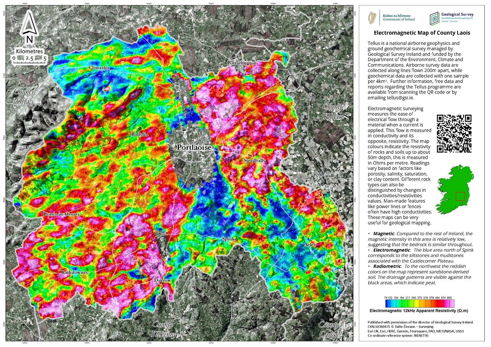
Pictured: Electromagnetic levels in Laois
“Geologists and geophysicists have a different way of looking at things, both in terms of time and space," said Koen Verbruggen, Director of Geological Survey Ireland.
"They use colour to represent different properties of rock or millions of years in time. People may remember the aircraft flying low above their homes and might have wondered was there anything unusual found in their county.
"These maps are a chance to show the results in a form that’s accessible to all and to show people a different way to look at County Laois," Mr Verbruggen finished.

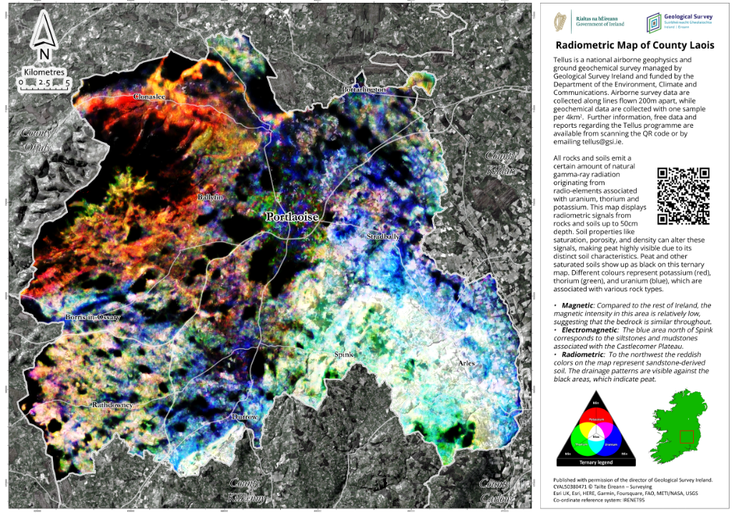
Pictured: Radiometric levels in Laois
The radiometrics map highlights County Laois’ sandstone derived soils of the Slieve Blooms, which appear red. The black areas on the same map represent peat. In the electromagnetic map, the blue area north of Spink correspond to the siltstones and mudstones of the Castlecomer plateau.
Airborne geophysics is a cost-effective means of detecting the physical properties of soil, rock, and water beneath the ground. The data can be used for various purposes, for example, geological mapping, mineral exploration, radon risk mapping, and geothermal energy exploration through the understanding of the subsurface.
The Tellus programme first began in Northern Ireland, and it is planned that surveys of the island of Ireland will be completed by 2026.

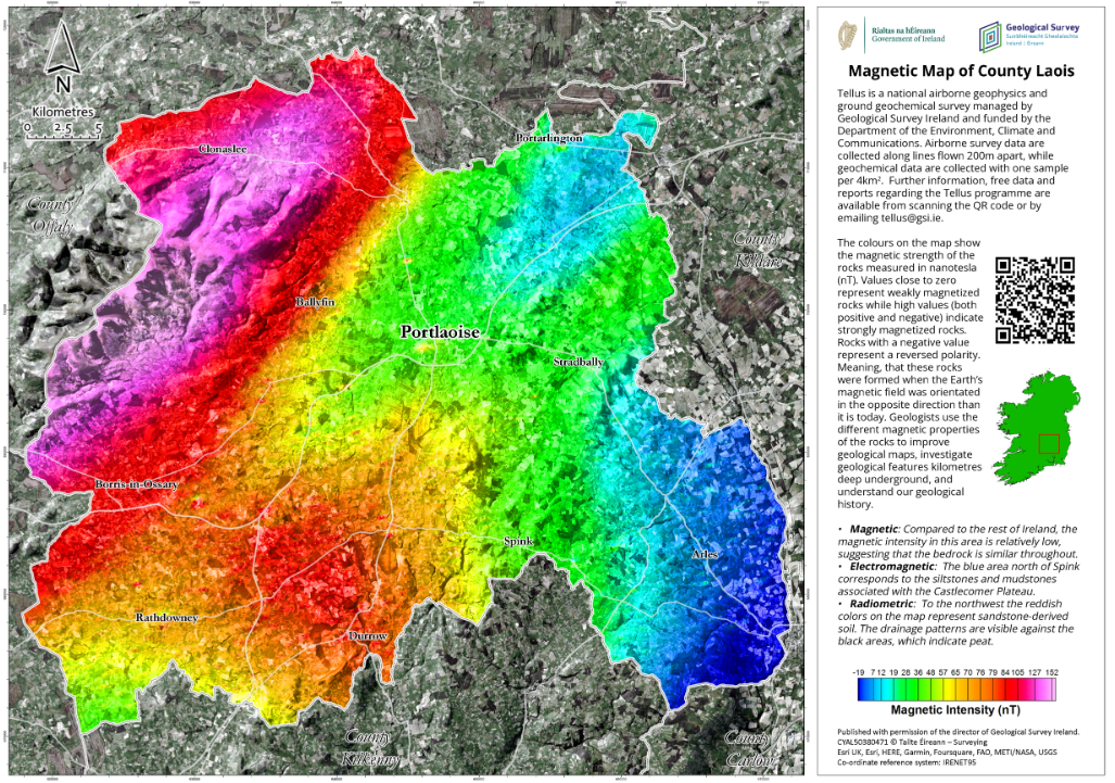
Pictured: Magnetic levels in Laois
The Tellus survey is a national programme designed to gather geochemical and geophysical data across Ireland, in other words, to examine the chemical and physical properties of our soil, rocks, and water. Tellus is undertaken by Geological Survey Ireland and is funded by the Department of the Environment, Climate, and Communications.
The Tellus maps of County Laois are available here.
Subscribe or register today to discover more from DonegalLive.ie
Buy the e-paper of the Donegal Democrat, Donegal People's Press, Donegal Post and Inish Times here for instant access to Donegal's premier news titles.
Keep up with the latest news from Donegal with our daily newsletter featuring the most important stories of the day delivered to your inbox every evening at 5pm.