

How now how long is the weather freeze going to last? Met Éireann has the latest forecast up to Christmas
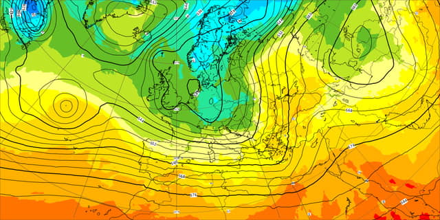

The cold snap is going to last through the week but Met Éireann expects some easing of its freezing grip at the weekend in its latest update.
In its latest forecast as the weekend ends, the forecaster says it will continuing very cold with severe frosts, icy conditions and freezing fog. While there will be a good deal of dry weather overall though there will be some wintry showers.
The forecaster says temperatures will also plunge to -7c but it could be colder in parts with -10c feared by Ireland's emergency response team.
A new Status Orange warning is in place for Thursday night going into Wednesday for low temperatures and ice. There'll be snow and sleet across parts of Ulster on Thursday night, most other places will stay dry.
Temperatures again as low as minus 7 degrees fairly widely, staying closer to zero to minus 2 degrees where fog thickens.
Met Éireann Status Yellow low temperature ice warning for Ireland that is valid until noon Friday, December 16.
Saturday will be mainly dry and sunny, but temperatures will start to creep up to as high 8 degrees on coasts.
While there is still a good deal of uncertainty in the forecast from Saturday night and Sunday onwards, the current indications suggest that an increasing southerly wind will bring rain and a spell of milder weather for a time.
Sot what is it saying beyond that and what's the outlook for Christmas?
Well, in its further outlook beyond that Met Éireann says there is a good deal of uncertainty in the forecast further out.
From Monday, December 19 to Christmas Day Met Éireann expects it to continue to be colder than normal, though current indications suggest temperatures will trend slightly closer to normal. While most areas will be drier than normal, the forecaster says the east and south will remain slightly wetter, with more frequent showers there. It warns of some potential for wintry precipitation in these showers, with the ongoing possibility of frost and ice.
In the week from St Stephen's Day to New Year's Day, Met Éireann says current indications suggest temperatures will return to around the average and most areas will experience near average rainfall also, though some eastern and southern parts may still see more frequent showers. MORE DETAILS BELOW TWEET.
National Forecast Issued at 11.10 am on Wednesday, December 14.
Wednesday: Frost and ice lingering in many areas. It will be mostly dry with long spells of winter sunshine. However, a few showers will affect northern and eastern coastal fringes. Highest temperatures of -1 to +3 degrees in moderate northeast breezes.
Temperatures will reach as low as minus 6 degrees widely overnight, and locally several degrees lower, temperatures at the coasts will be around minus 1 to plus 1 degrees. Remaining generally clear and dry in a light northerly breeze, though there will be a few showers in the north and northwest, falling as sleet and snow at times.
Thursday: Temperatures will remain below freezing during the morning everywhere, with some parts of the midlands staying well below freezing through the day, in the afternoon temperatures generally will be between zero and plus 2 degrees, a few degrees higher on coasts. It'll be mainly dry and sunny. There will be a few wintry showers in the north and northwest. Winds will be light northwesterly.
Friday: Foggy for a while in places, it'll be mainly dry with isolated showers on coasts creeping inland into western areas in the afternoon. Still very cold with afternoon temperatures no higher than plus 1 to 4 degrees in light to moderate southwest winds.
Lowest temperatures of minus 3 degrees to plus 2 degrees on Friday night, there'll be lingering showers of rain and sleet in western areas otherwise it will stay dry.
Saturday: Mainly dry and sunny, apart from isolated coastal showers in the south and west. Turning cloudier after nightfall. Daytime temperatures of 2 to 4 degrees generally, temperatures along the south coast will creep up to 7 or 8 degrees.
Sunday onwards: There is still a good deal of uncertainty in the forecast from Saturday night and Sunday onwards. Current indications suggest that an increasing southerly wind will bring rain and a spell of milder weather for a time.